
What makes it special
Namibia
Desert, distance and light.
Namibia covers roughly 825,000 square kilometres and holds under three million people, which makes it one of the least densely populated countries on earth. The Namib gives the country its name and its argument: a coastal desert running some 2,000 kilometres along the Atlantic from southern Angola into South Africa, between 50 and 160 kilometres wide, which has held arid or semi-arid conditions for somewhere between 55 and 80 million years. Sources differ and the Atacama has a rival claim, so the sensible line is that the Namib is arguably the oldest desert on earth. It certainly looks it.
The cold Benguela current running north up the coast is the mechanism behind almost everything here. It suppresses rainfall to under 10 millimetres a year on parts of the coast while generating dense fog on more than 180 days annually, and that fog is the only reliable water many desert organisms ever see. It also wrecked ships in numbers, which is how the Skeleton Coast got its name.
Germany claimed the territory in 1884 and held it until 1915, and the years between produced the towns clients will actually stay in — Lüderitz from 1883, Swakopmund from 1892, Windhoek rebuilt as a garrison capital. That period also produced the 1904 to 1908 war against the Herero and Nama, now widely recognised as the first genocide of the twentieth century and formally acknowledged by Germany in 2021. South African forces took the territory in 1915 and administered it under a League of Nations mandate and then, illegally, for decades after. Independence came on 21 March 1990; Walvis Bay was only transferred from South Africa in 1994.
Independent Namibia did something few countries have: it wrote environmental protection into its constitution, the first African state to do so, and in 1996 changed the law so that communal-area communities could register conservancies and hold rights over the wildlife on their land. More than eighty communal conservancies now exist, covering close to a fifth of the country, and combined with the national parks something over 40 per cent of Namibia sits under some form of conservation management. The results are measurable rather than rhetorical — desert-adapted black rhino and elephant recovered from near-collapse in the 1980s, and lodges in Damaraland and the Kunene operating as joint ventures with the conservancies whose land they sit on. This is worth explaining to clients properly, because it is the single most interesting thing Namibia does.
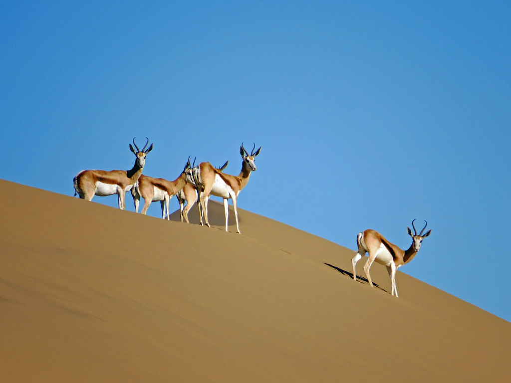
One thing to be blunt about at enquiry. Namibia does not compete with Botswana, the Mara or the Greater Kruger on game viewing, and it never will. Densities are low, the country is enormous, and outside Etosha in the dry months a full day can produce oryx, springbok and not much else. What Namibia sells is landscape, light and space — and it sells them better than anywhere on the continent. A client briefed to expect Big Five volume will come home disappointed. A client briefed to expect the best photographic country in Africa will not.
Sossusvlei and the Namib — the two nights nobody skips
The Namib-Naukluft Park runs to nearly 50,000 square kilometres, one of the largest conservation areas in Africa, and the dune sea inside it is what most people picture when they picture Namibia. Access is through the Sesriem gate, from which a 60-kilometre tarred road runs to the 2WD car park; the last six kilometres are deep sand and 4x4 only. Dune 45 stands 80 metres high at the 45-kilometre mark, its sand carried here over roughly five million years. Big Daddy, above Deadvlei, is around 325 metres. Deadvlei itself is the picture: a white clay pan studded with camelthorn skeletons that have stood for something in the order of six or seven centuries, since the Tsauchab river changed course, and which are too dry to rot rather than petrified.
Lodges on the private reserves bordering the park — Kulala Wilderness Reserve, NamibRand, Wolwedans — hold their own gate access or private entrances, which is the difference between reaching Deadvlei in the first light and reaching it behind a convoy of day visitors from Sesriem. NamibRand is also Africa's only Gold Tier International Dark Sky Reserve, and the night sky there is a sell in its own right. Dawn balloon flights over the dune sea are the one soft-adventure add-on worth the money.
The Skeleton Coast — the most expensive nights in the country, and worth it
The Portuguese called this coast the sands of hell; the San called it the land God made in anger. Both are fair. Fog, surf and shifting sandbanks have taken hundreds of vessels, from the Bom Jesus, wrecked in the 1530s and found again in 2008, to the Dunedin Star in 1942, whose rescue attempt cost more lives than the wreck did and gave the coast its modern name. The Eduard Bohlen now lies several hundred metres inland, the sea having retreated around it. At Cape Cross the Portuguese navigator Diogo Cão planted a stone cross in 1486; the site now holds one of the largest Cape fur seal colonies in the world, and clients should be warned that it is a spectacle for the eyes and an ordeal for the nose.
The northern wilderness concessions are fly-in only, reached by light aircraft on gravel strips, with a handful of beds and no road access at all.
Damaraland and the Kunene
North of the Ugab river the country turns to red rock, dry riverbeds and open gravel, and this is where the desert-adapted wildlife lives. Elephant here range across enormous home territories, covering as much as 70 kilometres in a day between water points, and the black rhino population is the largest free-roaming group outside any national park anywhere. Save the Rhino Trust has worked these hills since 1982, and the tracking on foot done with its trackers and conservancy game guards is the most serious wildlife experience in Namibia.
The culture and the archaeology are equally strong. Twyfelfontein holds one of the densest concentrations of rock engravings in Africa, well over 2,000 of them, and was inscribed in 2007 as Namibia's first UNESCO World Heritage Site. An hour or so north, the Brandberg massif rises to Königstein at 2,573 metres, the highest point in the country, and shelters the painting known as the White Lady — which is roughly 2,000 years old and, on current reading, neither white nor a lady. Further north again, the Kaokoveld and the Himba communities along the Kunene are a genuine, and genuinely remote, cultural add-on for clients with the days.
Etosha — the game-viewing stop
Etosha was proclaimed on 22 March 1907 by Friedrich von Lindequist, Governor of German South West Africa, under Ordinance 88, at something close to 80,000 square kilometres. Successive reductions brought it to today's 22,270. At its centre the Etosha Pan covers about 4,760 square kilometres, some 130 kilometres long and up to 50 wide, a dry salt flat that mirages into a white nothing and floods only briefly in a good wet season. The park holds around 114 mammal and 340 bird species, and is the single most important custodian of black rhino in the world.
The mechanism is water, not tracking: in the dry months the game has nowhere to drink except the springs and pumped holes strung along the pan's southern edge, and you sit at one and let it come. The floodlit waterholes at Okaukuejo, Halali and Namutoni run all night, and Okaukuejo is the most dependable black rhino viewing on the continent. Be honest about the accommodation, though. The state camps are functional rather than luxurious and the driving is road-bound and self-drive-heavy. For this segment the answer is the private ground on the boundary — Ongava on the southern edge, Onguma to the east — which offers off-road driving, night drives and rhino on its own traverse.
Swakopmund and Walvis Bay — the break in the drive
Swakopmund was founded in 1892 as the harbour of German South West Africa for the simple reason that Walvis Bay, the only good deep-water anchorage on the coast, was British. The result is a Wilhelmine town of gabled facades, palm-lined streets and a jetty, dropped between dune and Atlantic, and it remains the place Namibian itineraries go to eat well and stop moving for two days. Thirty kilometres south, the Walvis Bay lagoon is a Ramsar wetland holding tens of thousands of lesser and greater flamingos and a resident pelican population, best worked by kayak among the seals.
Sandwich Harbour, 55 kilometres further south, is the coastal set piece: a lagoon where 100-metre dunes drop directly into the surf, reachable only by tide-dependent 4x4 with a licensed operator. Set expectations honestly — Swakopmund is a working port town rather than a resort, the fog often does not lift until midday, and the Benguela keeps the sea at around 15 degrees, so nobody is swimming.
The south — Fish River Canyon, Lüderitz and Kolmanskop
The Fish River Canyon runs about 160 kilometres, reaches 27 kilometres across and drops as much as 549 metres. It is routinely marketed as the second largest canyon in the world; that claim depends entirely on how you define largest and does not survive scrutiny, so do not repeat it. What is defensible, and impressive enough, is that it is the largest canyon in Africa. The 88-kilometre hiking trail down to the hot springs at Ai-Ais is permitted only between 1 May and 15 September, because summer temperatures on the canyon floor reach 48 degrees.
West on the coast, Lüderitz was established in 1883 on the bay the Portuguese called Angra Pequena and remains an odd, wind-scoured pocket of Art Nouveau architecture. Four kilometres inland, diamonds were picked off the sand in 1908 and Kolmanskop went up around them — a company town with a ballroom, a hospital with the first X-ray machine in the southern hemisphere, and an ice factory, all abandoned by the mid-1950s when the richer fields moved south. The desert has been reclaiming the houses ever since, and the sand-filled rooms are among the most photographed interiors in Africa.
Two areas complete the map. The Zambezi Region, the panhandle formerly called the Caprivi Strip, is the wet counterweight to everything else here — the Okavango, Kwando, Linyanti and Zambezi rivers, riverine forest, elephant and buffalo in numbers, and a natural land bridge to Chobe and Victoria Falls. The Kalahari in the south-east, red dunes and grass rather than sand sea, works well as a soft first or last night out of Windhoek.