
What makes it special
Victoria Falls
The Zambezi at full volume, from either bank.
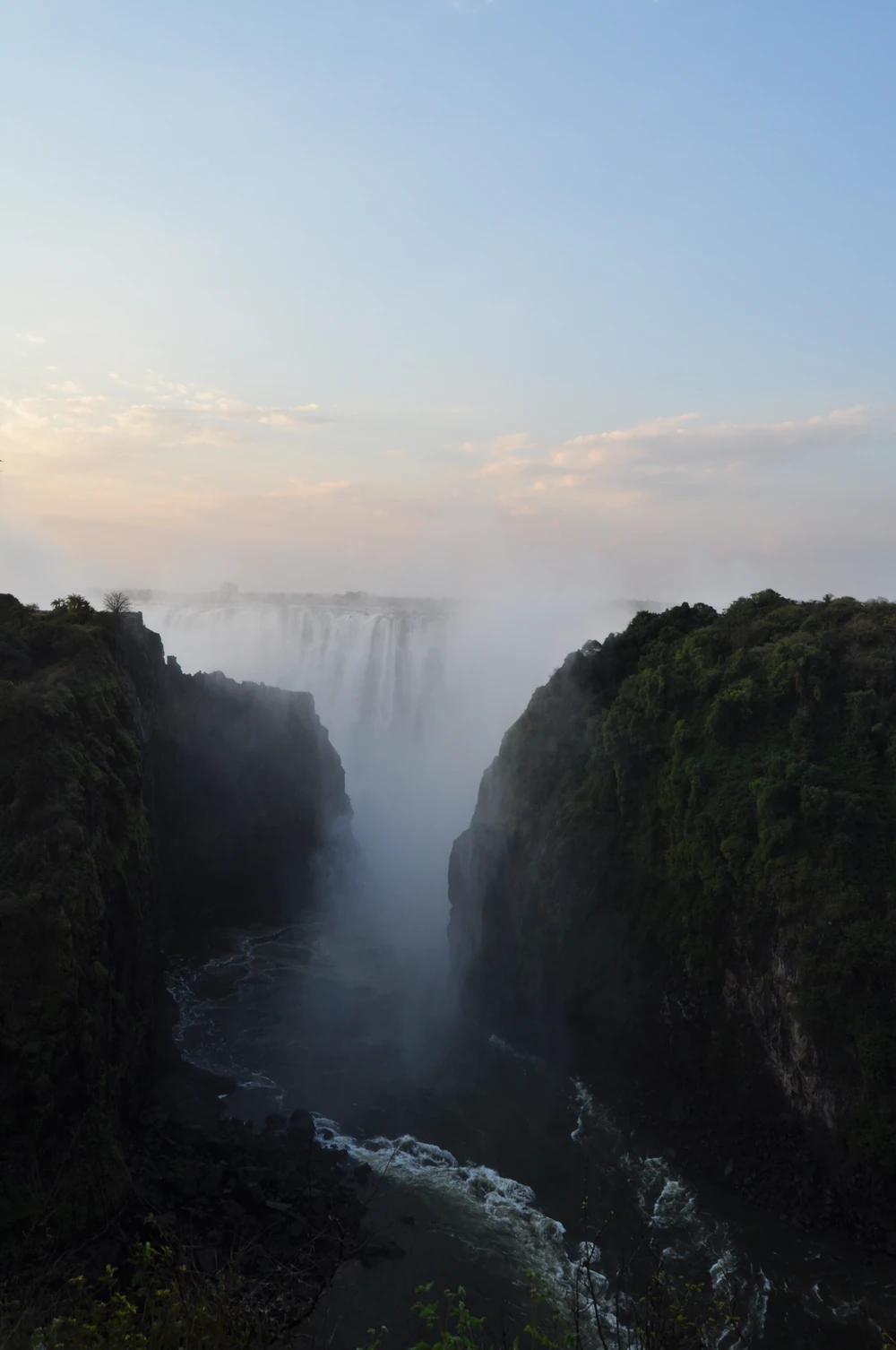
The Zambezi arrives without warning. It has run wide and slow across a flat sheet of Jurassic basalt, braided around islands and palms, and then the whole river drops off a straight lip 1,708 metres across into a chasm reaching 108 metres at its deepest. Nothing else puts this much water over a single unbroken edge: this is the largest sheet of falling water in the world, and in flood the spray climbs over 400 metres and is visible 50 kilometres away.
The Lozi called it Mosi-oa-Tunya, the smoke that thunders; the Tonga, Shungu Namutitima, boiling water. David Livingstone reached it on 16 November 1855, paddled out to the island at the lip that now carries his name, and wrote that scenes so lovely must have been gazed upon by angels in their flight — the line the helicopter operators still trade on. He named the falls for Queen Victoria, and was not the first to see them by several centuries.
Fifty years later the railway arrived. Cecil Rhodes wanted his Cape-to-Cairo line to cross here and told his engineers to build where the trains would catch the spray; he died in 1902, two years before work began. The bridge opened on 12 September 1905, a main arch of 156.5 metres with the deck 128 metres above the water, and it remains the only rail link between the two countries. The Victoria Falls Hotel had opened the year before; Livingstone, on the Zambian bank, was capital of Northern Rhodesia from 1911 to 1935.
The falls are cutting backwards along fracture lines in the basalt, and the zigzag gorges below are eight previous positions of the same waterfall. UNESCO inscribed the site in 1989 under both names, Mosi-oa-Tunya / Victoria Falls, across 6,860 hectares of Zambian and Zimbabwean parkland. The number that governs every sale, though, is the flow: the Zambezi floods from February to May, peaks in April, then drops to a November minimum averaging roughly a tenth of the April figure. Two clients six months apart see two different waterfalls, and only one sees the brochure.
The Zimbabwean side — the view, and the town that sells it
Roughly three-quarters of the falls face sits in Zimbabwe, and it is the better view in almost every month. Victoria Falls National Park is small at 23 square kilometres, but its path runs the length of the face with sixteen numbered viewpoints, from Devil's Cataract past Main Falls and Rainbow Falls — the highest section, at 108 metres — to Danger Point, opposite the Eastern Cataract. The walk crosses a strip of true rainforest kept alive by spray alone, with pod mahogany, ebony and ivory palm growing where the surrounding country is dry woodland. Entry is about US$50 per international adult, and this side never dries out.
Victoria Falls town is under two kilometres from the entrance and had 35,199 residents at the 2022 census. It exists to sell activities and does not pretend otherwise: curio stalls, over two hundred advertised excursions, and a level of street approach clients should be briefed on. The counterweight is the Victoria Falls Hotel, Edwardian, 1904, with high tea on a terrace framing the bridge. A first-time client should sleep this side: most of the view, most of the beds, better airlift.
The Zambian side — Livingstone, the island and Devil's Pool
Zambia holds the eastern quarter: the Eastern Cataract, seen from the Knife-Edge Bridge across a gap that in flood is pure spray, and a steep path down to the Boiling Pot where the whole river turns and exits through the Second Gorge. It is the closer, wetter, more vertiginous view, and in low water it reduces to bare rock — a client sold Zambia alone in November will not see much. Mosi-oa-Tunya National Park runs 66 square kilometres along the riverbank and holds a managed group of southern white rhino: an hour on foot, but not a safari.
Livingstone is a working town of 177,393 people rather than a resort, which some guests prefer. Its museum, founded in 1934 as the David Livingstone Memorial Museum and renamed at independence in 1966, is Zambia's oldest and holds letters and journals given by the Livingstone family. The commercial reason to be on this bank, though, is Livingstone Island and Devil's Pool — the lip where Livingstone stood in 1855, and the eddy behind it that can be swum when the river drops. The window runs roughly mid-August to mid-January and is set by water level, not calendar. Position this bank for repeat visitors and guests who want quiet.
The river above the falls – the place to be
The upper Zambezi is the part of this destination that reads as luxury travel rather than sightseeing. Above the lip the river is broad, island-studded and calm enough for the sunset cruise that is the standard first evening on either bank: hippo, crocodile, elephant crossing between islands, spray on the horizon downstream. Zimbabwe's Zambezi National Park, 56,000 hectares split off from the falls park in 1979, runs 40 kilometres upstream with elephant, buffalo, lion, sable and over 400 bird species — a decent morning, not a safari leg. It is also tiger fishing water.
The gorge below — Batoka, and the adrenaline economy
Below the falls the Zambezi runs through six gorges, the Second carrying the bridge, the Songwe the deepest at 140 metres. It is one of the strongest commercially rafted stretches of grade five water anywhere. From roughly August to December the low-water run launches from the Boiling Pot beneath the falls; from January to April high water forces the start down to rapid 11, some 10 kilometres downstream, and multi-day trips stop. It is a genuine grade five river with a hot, steep climb out, and does not suit every client who says yes by email.
The bridge carries a 111-metre bungee, a gorge swing and a zip-line, plus a guided bridge tour that puts guests on the 1905 structure without a harness — the better sell here. One watching brief: the proposed 2,400 megawatt Batoka Gorge hydroelectric scheme, now in procurement through the Zambezi River Authority, would eventually flood part of the rafting run.
The falls as a hub
Victoria Falls earns its place as much for its connections as for its waterfall. Two international airports on opposite banks, a road border and short onward hops make this the natural hinge between southern Africa's safari regions: Hwange lies about 109 kilometres south-east by road, Kasane and Chobe roughly ninety minutes west, and Mana Pools and the Lower Zambezi a light-aircraft leg away. Clients can land, take three nights on the river, and be in a game reserve by the fourth day.